GWC’s Weather Week That Was – July 27 – August 2, 2025
GWC’s Weather Week That Was – July 27 – August 2, 2025
Location: South Plainfield, NJ
Latitude: 40.58 N
Longitude: 74.42 W
| Date | High Temp | Low Temp | Diurnal Range | Rainfall | Peak Rainfall Rate | High Pressure | Low Pressure | Pressure Change |
| 7/27/2025 | 86 | 69 | 17 | 0.03 | 0.04 | 30.06 | 29.87 | 0.19 |
| 7/28/2025 | 95 | 71 | 24 | 0.00 | 0.00 | 29.98 | 29.92 | 0.06 |
| 7/29/2025 | 97 | 72 | 25 | 0.00 | 0.00 | 29.99 | 29.92 | 0.07 |
| 7/30/2025 | 96 | 73 | 23 | 0.00 | 0.00 | 29.99 | 29.88 | 0.11 |
| 7/31/2025 | 88 | 66 | 22 | 0.23 | 6.62 | 29.94 | 29.87 | 0.07 |
| 8/1/2025 | 73 | 62 | 11 | 0.08 | 0.18 | 30.19 | 30.01 | 0.18 |
| 8/2/2025 | 80 | 58 | 22 | 0.00 | 0.00 | 30.22 | 30.14 | 0.08 |
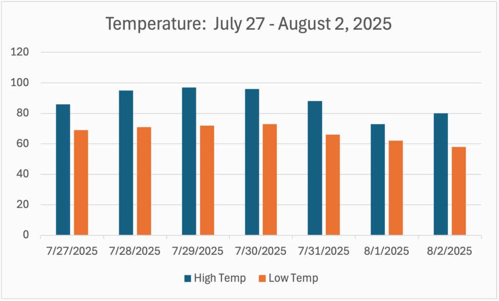
Temperature for the Week of July 27 – August 2, 2025
- Average High Temperature: 87.9°
- Max Temperature: 97° on July 29th
- Min Temperature: 58° on August 2nd
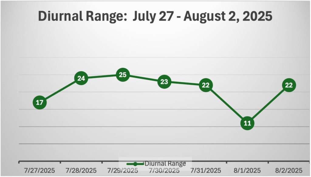
Diurnal Range for the Week of July 27 – August 2, 2025
NOTE: The diurnal range of temperature is the difference between the high temperature and the low temperature on a given day.
- Average Diurnal Range of Temperature: 20.6°
- Max Diurnal Range: 25° on July 29th
- Min Diurnal Range: 11° on August 1st
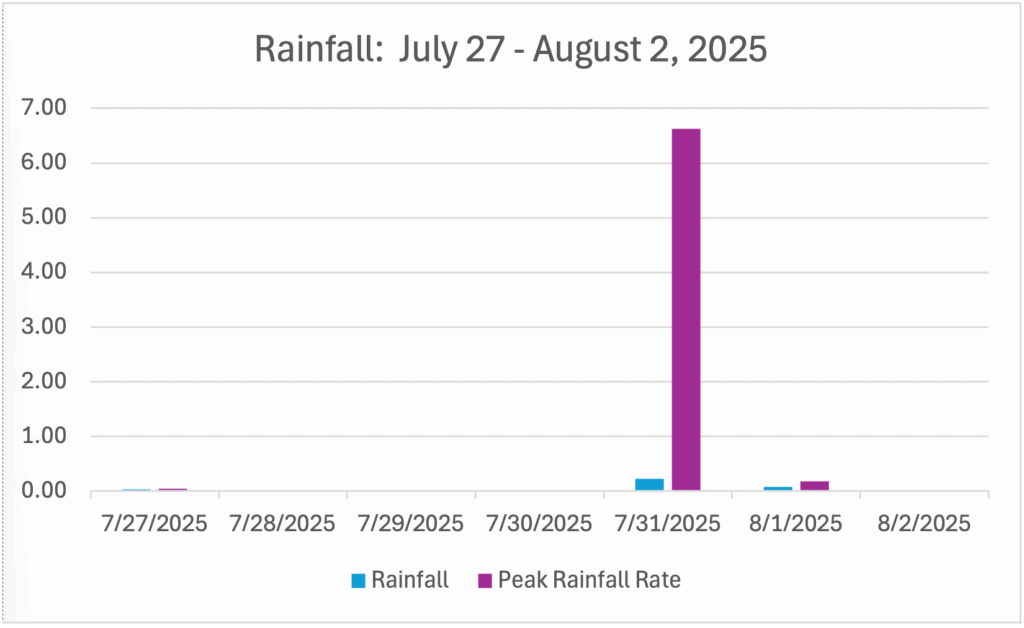
Rainfall for the Week of July 27 – August 2, 2025
- Average Daily Rainfall: 0.05 inches
- Max Rainfall: 0.23 inches on July 31st.
- Min Rainfall: 0.00 inches on July 28th, 29th, 30th, and August 2nd.
- Peak Rainfall Rate: 6.62 inches per hour on July 31st.
Pressure for the Week of July 27 – August 2, 2025
- Max Pressure: 30.22 on August 2nd
- Min Pressure: 29.87 on July 27th and July 31st
- Largest Pressure Drop: 0.19 of an inch or 6.3 millibars from 12:00 AM to 6:31 PM on July 27th.
- Largest Pressure Rise: 0.35 of an inch or 11.7 millibars from 1:15 PM on July 31st to 9:00 AM on August 2nd.

Summary
The last days of July and the first two days of August 2025 were defined by two major weather stories. A heatwave for the first part of the week, and another round of fierce severe weather on Thursday, July 31st. From July 28th to July 30th, the third major heatwave of the year gripped Northwestern Middlesex County and the rest of Central Jersey.
During those three days, the high temperature was at least 95 including the warmest day of the month on July 29th at 97 degrees. The heatwave finally broke on July 31st when severe storms produced the second-ever Tornado Warning at Greg’s Weather Center. The first was during the onslaught brought on by the remnants of Hurricane Ida on September 1, 2021. The storms produced only 0.23 inches of rain, but it was a brief torrential rain with a rainfall rate of 6.62 inches per hour at 2:19 PM.