
Severe Weather Deluge Paralyzes Region

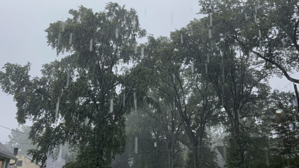

Photos of the severe weather that paralyzed the region with a record-setting deluge on July 14, 2025.
Storms Produce Third-Largest One-Day Rainfall at GWC
SOUTH PLAINFIELD, NJ – For the second time in a little over ten days, severe thunderstorms assaulted Northern Central Jersey. Instead of hurricane-force winds, hail, and heavy rains, many towns across Middlesex, Somerset, and Union counties were hit with torrential rains, frequent and vivid lightning, and loud thunder. The severe weather deluge paralyzed the region with the third-largest one-day rainfall at Greg’s Weather Center in South Plainfield, NJ.
Following a week and a half of enduring the onslaught of tropical heat and humidity, GWC received a potent round of severe thunderstorms that lived up to the forecast. In many respects, the rainfall amounts that resulted from Monday afternoon and evening’s deluge exceeded predicted amounts. Rainfall amounts at GWC ranged from 2.4 inches to 3.92 inches per hour at the storm’s peak. The final rainfall total when it was all said and done was 5.52 inches.
Monday’s final rainfall tally only ranks behind those from Tropical Storm Floyd on September 16, 1999 (11.67 inches) and the remnants of Hurricane Ida on September 1, 2021 (7.38 inches) at GWC. The excessive rainfall dramatically increased the monthly tally for July 2025 at GWC to 7.85 inches, which ranks as the 8th wettest month on record. Two of the first seven months of this year are ranked in the Top 11 of wettest months on record at GWC.
More troubling, though, was the flooding produced by these intense thunderstorms. Floodwaters did eventually emerge in the neighborhood by GWC as night fell on Monday. Fortunately, the rain tapered off to prevent the kind of extensive flooding that occurred with Hurricane Irene in August 2011 and Ida’s remnants four years ago. Other areas around South Plainfield and nearby towns were not so lucky. Once again, North Plainfield and Plainfield suffered the brunt of these storms with flash floods that became roaring rapids along Route 22.
Also affected were towns such as Scotch Plains, Westfield, Linden, Clark, Berkeley Heights, Summit, New Providence, Edison, Piscataway, Watchung, Bound Brook, Manville, and Somerville. The footage on social media was astounding. One video showed cars sitting in traffic while rushing water crossed Route 22 in North Plainfield. Another clip depicted monster 4×4 trucks and cars trying to navigate the raging river of floodwaters in North Plainfield, Plainfield, and Somerville. One showed a Plainfield resident being carried by the strong current of the floodwaters. Another showed a dramatic rescue in Scotch Plains.
This latest round of severe weather claimed two more lives in Plainfield. Powerful floodwaters tore up portions of Route 22 and adjacent roads in Somerset and Union counties. Waters from the Clark Reservoir topped over into Raritan Road near Featherbed Lane in Clark. New Market Avenue in South Plainfield was closed. Traffic on Park and Maple Avenue was halted for as long as several hours. Lightning struck a tree in the Sleepy Hollow section of Plainfield. Floodwaters stranded cars at the Park Avenue exit on Route 22 in Scotch Plains.
Rainfall amounts in Middlesex, Morris, Somerset, and Union counties ranged from anywhere between an inch to 7 inches. Below are some of the higher rainfall totals around Central Jersey from this latest round of severe weather:
| Location | Rainfall Total (in inches) |
| Clark, NJ | 6.67 |
| Watchung, NJ | 6.51 |
| Westfield, NJ | 6.40 |
| Woodbridge, NJ | 6.27 |
| Middlesex, NJ | 6.22 |
| New Providence, NJ | 5.79 |
| South Plainfield, NJ | 5.53 |
| Edison, NJ | 5.35 |
| Mountainside, NJ | 5.35 |
| Linden, NJ | 5.10 |
| North Plainfield, NJ | 4.89 |
| Piscataway, NJ | 4.84 |
| Long Hill, NJ | 4.47 |
| Franklin Township, NJ | 4.31 |
| Bridgewater, NJ | 4.16 |
| Manville, NJ | 4.03 |
| Scotch Plains, NJ | 4.02 |
| Chatham, NJ | 3.71 |
Both the Storm Prediction Center in Norman, Oklahoma, and the National Weather Service offices in Mount Holly, New Jersey, and Upton, New York provided ample warnings for these storms. The SPC did place much of the Mid-Atlantic region under either a marginal or slight risk for severe weather. In addition, the SPC also indicated a moderate risk for excessive rainfall for a large swath of the I-95 corridor from Eastern Pennsylvania into New Jersey.
The severe weather and heavy rainfall were due to a combination of several factors, according to Marshall Shepherd of Forbes magazine. Peak heating of the day, which produces the rising motion. A shortwave, which served as the spark. Outflow boundaries and a sea breeze front combining to produce pockets of cool air. And low pressure ahead of a cold front. Adding to this combustible mix of weather factors was the slow motion and training of the storms over the same area.
One more ingredient that is becoming more of a culprit in these kinds of flash flood scenarios is the overdevelopment and increased urban sprawl that make up much of the landscape in this region. The striping of trees, grass, and dirt in favor of concrete buildings and sidewalks, as well as asphalt-paved roads, creates an environment more conducive to the absorption of heat. In turn, the heat can hold more moisture, which results in higher CAPE and PWAT values.
Greg’s Weather Center received most, if not all, of its 5.52 inches over three to four hours. From 5:00 PM to 6:00 PM, approximately 1.32 inches of rain fell. The peak rainfall of 2.44 inches fell between 6:00 and 7:00 PM. Another 1.52 inches accumulated between 7:00 and 8:00 PM. The peak rainfall rate of nearly four inches per hour occurred at 5:42 PM. In comparison, the peak rainfall rate during Ida’s remnants was 4.97 inches per hour at 5:45 PM on September 1st.